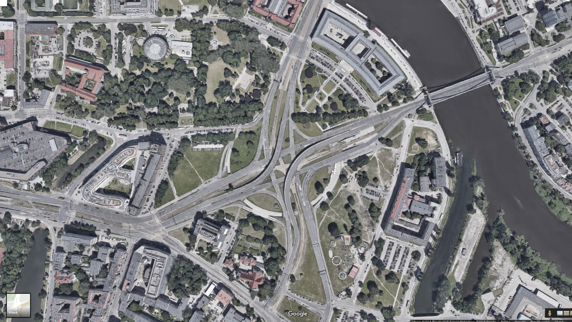
The concept of the work derives from the meaning and context of the Plac Społeczny (en: Social Square) in Wrocław which has become a subject to many discussions and social debates, both among the city authorities and the local community. The very name of the square, indicating its social function, is in contradiction with the actual state. This place is more a kind of transit belt for car traffic, where people move alongside overpasses and tracks. The structure of streets and sidewalks gives the impression that the centrifugal force „pushes out” the residents outside the square.
Motywem przewodnim tej pracy stał się wrocławski Plac Społeczny, wokół którego ogniskuje się wiele dyskusji, zarówno wśród władz miasta jak i lokalnej społeczności. Sama nazwa placu, wskazująca na jego społeczną funkcję, pozostaje w sprzeczności ze stanem faktycznym. Miejsce to jest swego rodzaju pasem tranzytowym dla ruchu samochodowego, gdzie obok estakad i torowisk, przemieszczają się ludzie. Struktura ulic i chodników sprawia wrażenie jakby siła odśrodkowa „wypychała” mieszkańców na zewnątrz placu.
The project is based on the Google Street View application, which has been modified for the purposes of the project and embedded on the author’s website: www.forumsociale.memorymorph.pl.
The application has been extended to include custom transition routes. After creating over one hundred 360-degree photographic panoramas, we have registered, digitized the roads that people use: sidewalks, paths, underpasses, stops, driveways and stairs that are usually overlooked by Google. We added new panoramas to the Google application, as a result of which an alternative map was created with a network of connections between streets and routes of residents’ movement. The whole creates a kind of extended city plan. However, instead of people, there are internet bots moving across this map. The robotic movement is generated by an algorithm attached to the Google Street View application. According to the algorithm, the program moves between successive panoramas at specific time intervals, makes a random selection in case of a fork in the road and moves only within a closed area (Social Square and the nearest neighborhood). Each page call in the browser causes the program to be reloaded, i.e. starting the next bot.
Praca zbudowana jest w oparciu o aplikację Google Street View, która została zmodyfikowana na potrzeby projektu oraz osadzona na autorskiej stronie internetowej: www.forumsociale.memorymorph.pl
Aplikacja została rozszerzona o niestandardowe trasy przejścia. Dzięki wykonaniu ponad stu panoram fotograficznych 360° zarejestrowaliśmy i zdigitalizowaliśmy drogi, jakimi poruszają się ludzie: chodniki, ścieżki, przejścia podziemne, przystanki, podjazdy i schody, które zwyczajowo są pomijane w Google Street View. Nowe panoramy dodaliśmy do aplikacji Google, w wyniku czego powstała alternatywna mapa tworząca siatkę połączeń pomiędzy ulicami i trasami poruszania się mieszkańców. Po tak przetworzonej mapie, zamiast ludzi, poruszają się internetowe boty. Ruch botów generowany jest przez algorytm, który został dołączony do aplikacji Google Street View ładowanej w stronie przeglądarki. Zgodnie z algorytmem, program przemieszcza się między kolejnymi panoramami w ustalonych interwałach czasowych, dokonuje losowych wyborów w przypadku rozwidlenia dróg i porusza się tylko w obrębie zamkniętego obszaru (Plac Społeczny i najbliższe okolice). Każde wywołanie strony w przeglądarce powoduje załadowanie się programu na nowo, czyli uruchomienie kolejnego bota.
Thus, the social square was made available not to people, but to machines that automatically, in accordance with the algorithm we created, constantly move on an alternative map. Each page view will generate another autonomous route that can be viewed in two ways: in the form of panoramas, similar to Google Street View and on the map (referring to the Google Earth satellite map). Watching the route of the bot’s passage, you can travel with the machine and in this way watch the space of the Social Square. The viewer does not know which route will be chosen by the machine, so he is deprived of his efficient function. It may be deluded that the route chosen by the bot leads somewhere, but the machine is programmed in such a way that its wandering is drifting aimlessly. Bots do not go to a specific place, do not try to escape, get to the center, and if there are more of them, they would not avoid each other, but also do not try to make their routes intersect.
Plac społeczny został więc udostępniony nie ludziom, a maszynom, które automatycznie, zgodnie ze stworzonym przez nas algorytmem, przemieszczają się nieustannie po alternatywnej mapie. Każda odsłona strony wygeneruje kolejną, autonomiczną trasę, którą można oglądać na dwa sposoby: w formie panoram, analogicznie jak w Google Street View oraz na mapie (nawiązującej do satelitarnych map Google Earth). Oglądając trasę przejścia bota można podróżować razem z automatem i w ten sposób oglądać przestrzeń Placu Społecznego, iść ścieżkami wydeptanymi przez ludzi, ale także docierać do miejsc, które są dla pieszych niedostępne. Oglądający nie wie, jaką trasę wybierze automat, zostaje więc pozbawiony swojej funkcji sprawczej, może obserwować to miejsce jedynie za pośrednictwem maszyny. Można ulec złudzeniu, że trasa wybrana przez bota dokądś prowadzi, jednak automat zaprogramowany jest w ten sposób, że jego wędrówka jest dryfowaniem bez celu. Boty nie zmierzają w konkretne miejsce, nie starają się uciec, dotrzeć do centrum, a jeśli jest ich więcej – nie unikają siebie, ale też nie dążą do tego aby ich trasy się przecięły.
